 Good Morning, A beautiful Smoky Mountain sunrise full of pinks and oranges welcomes another day and the final weekend of the 2022 lodge season. We have more frigid temps on deck, but that likely won’t deter travelers from flocking to the mountains today. This Saturday begins in the teens, but the ever-present breeze has us feeling like we‘re still in the single digits. This will be the case for at least another 24 hours before the mercury is expected to climb back up to a more seasonably appropriate range. We might even register wind chills below zero tonight as gusts cut as much as 35mph. Thank goodness for the sunshine to warm our spirits. Continue to pay close attention to any icy patches on trail. The crew is looking forward to its annual Mountain Thanksgiving tradition this weekend, one final grand feast enjoying each other’s company as the conclusion to a memorable season draws near. Have a great day. 
0 Comments
 Good Morning,
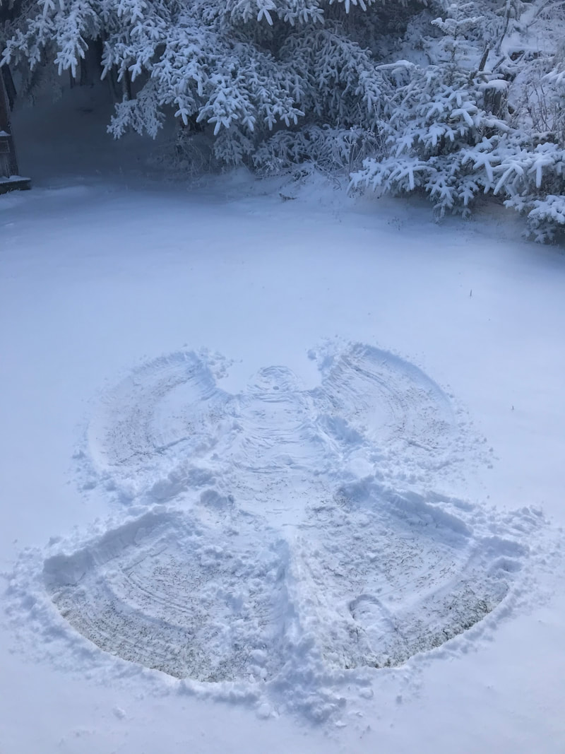
It’s another day waking up to glorious sunshine, but also some more frigid cold. The pancakes and eggs are sizzling nice and hot, but outside it’s in the single digits once again. And with wind gusts of 30mph possible today, odds are the thermometer will stay parked right where it is with wind chills sticking close to 0° or below. It’s going to be like this day and night all the way through the weekend, so don’t let the bountiful sunshine full you into thinking it’s warm and toasty up top (unless you’re an overnight guest with a heated cabin!). Layer up and then layer some more. Patchy ice remains and is quite manageable for the sure-footed, but better safe than sorry by remembering the traction devices. Today is the last opportunity for those interested in completing the survey related to vehicle parking changes being put forth by the NPS beginning in March 2023. After 5:00 PM today, the online survey will no longer be accessible on this blog or our official reservations website. Of course, anyone still hoping to voice future parking fee/policy comments or questions to the NPS can continue to do so at anytime by following the various links to NPS contacts provided in the survey. Thank you to all that have participated in the survey thus far. Have a great day.  Good Afternoon, The sun is out and shining brightly over the Smokies, but instead of guests opening their cabin doors to step outside into glowing warmth, it’s a biting bone chilling cold. The thermometer bottoming out at 8° overnight, combined with light winds, had it feeling down around 0°. Visitors to the mountain in the coming days best get used it, because that’s the temperature range we’ll be spending the bulk of our time. Come Friday gusts will ramp up to about 30mph which could us going subzero at times. Many layers and accessories are your best friend while spending time on the mountain these days. Even though the remaining ice is patchy, particularly in the shaded areas and northern facing slopes, continue to have the traction devices handy. Aside from that, it should be a spectacular stretch of sunny days ahead. With such cold air typically come the clearest and most distant views of the year. Have a great rest of the day.   Good Morning, And thus begins the week of “lasts” on the mountain before we shut things down for the winter. Last days of the week, last opportunities to catch sunrise or sunset, last afternoon shifts for crew, last meals by candle light just to name a few. Even though winter doesn’t officially start for more than a month, it’s about to feel like the big chill is already here with the forecasted temps. Yesterday’s steady rain actually worked some magic in melting a decent amount of snow and ice, helping to make walking conditions a bit less treacherous with each passing hour. But now that temps have been dropping steadily since last night, whatever surface that was left wet will now turn back to ice. Folks are waking up this morning to a cloud sea below and dappled clouds and blue sky above. The good news is that we might not see any more rain or snow before we close our doors next Wednesday. The real kicker though is that we’ll be spending just about every day below freezing until that point. In fact, beginning this afternoon the wind chills will have it feeling like 0-10° all day and all night well into next week. So don’t be fooled by the abundant sunshine that’s coming. Adequate warm layers and traction devices will still be essential for spending extended time atop the mountain. Gusty winds of 25mph will be a constant presence now and through the weekend. All roads accessing the mountain’s trails are open, but continue to watch for slick spots when en route. Have a great day.   Good Morning, It’s going to be a slippery sloppy day on the mountain to mark the halfway point of November. US 441 (Newfound Gap Rd) has been temporarily closed since last night because of the current high winds and possibility of icy conditions. There is no timetable for when it will reopen, but hikers still have access to trails emanating from Cherokee Orchard and Roaring Fork. Those trails are all longer than Alum Cave, thus requiring earlier starts to ensure reaching the lodge in time for relaxation and supper. A Wind Advisory is in effect until 5:00 PM tonight with gusts of 55mph. Intermittent rain showers started a few hours ago and are expected to last well into Wednesday morning. Temps up top managed to stay above freezing during the night, so we dodged receiving any new snow for the moment, but plenty of patchy snow and ice remain. Another chance for freezing rain or snow will take place on the back side of this storm tomorrow as temperatures plummet. Strong winds shifting out of the north will contribute to frigid temps for several days beginning Wednesday. We’re talking all day and night with wind chills in the single digits. Thankfully the sun should rejoin us tomorrow afternoon, but it will contribute little to providing any warmth at our elevation. Traction devices and warm layers from head to toe are an absolute must. Trails are going to be super slick up top and squishy down low. Be safe and have a great day.   Good Morning, One superbly sunny day has led into another. Well, at least to start anyways. Mostly clear skies today will eventually give way to cloudier conditions this afternoon followed by wind, rain, and snow showers this evening. Little to no accumulation is expected, and winds will gust upwards of 45mph. We’re watching the sunrise over High Top with temps in the mid 20s to kickstart this third week of November, and we are hoping the mercury rises above freezing later this afternoon. If the extended forecast is any indication, this might be the last time we feel temps above 32° the rest of the season. More overnight lows with windchills in the single digits are on the way. So if you’re an overnight guest with a reservation any of these last 9 nights of the season, come dressed for the cold. There is still plenty of patchy snow on the ground, and now that hundreds of footsteps have trampled down what ice and snow was on trail, surfaces are going to be super slick. Traction devices are going to be an absolute must for safe travel now until the end, especially with more rain, snow, and frigid temps on the way. Tuesday looks like it will be the worst weather day of the week, with abundant sunshine lining up for several days after. There was a brief closure of US 441 (Newfound Gap Rd) yesterday morning, but the NPS got the slippery situation resolved in time to reopen it for the afternoon. All roads accessing the mountain’s trailheads are open, but continue to use caution while driving to and from. Have a great day.  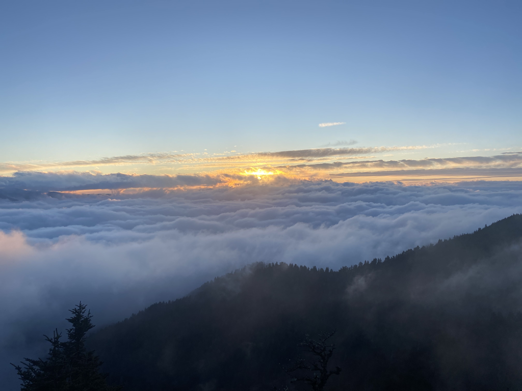 Good Morning, And just like that, the higher elevations are coated in snow. Been a busy morning scraping steps, porches, and solar panels. All of Saturday was a cool, cloudy, and misty day, hardly attractive for outdoor exploration. By supper time the temps started to drop, and despite occasional glimpses of stars and a bright rising moon, ice began to form and flurries found a way to fly. Everyone waking up this morning was greeted by a dusting of powder, not quite an inch deep, and super slick surfaces. Occasional gusts have temps in the low teens feeling more like single digits. All roads appear to be open despite the chilly and icy conditions that extend down several thousand feet in elevation. We’re basking in glorious sunshine above a cloud sea. All visitors need to use caution on trail and while driving in the park today, even once the sun comes out for the lowlands. Traction devices will be a must for safe rambling, especially this high up. We aren’t expected to get above freezing again until Monday afternoon. Winds will continue to be a factor today, gusting as much as 35mph at times. Layer up and tread carefully if out trying to see some snow. Have a great day.    Good Morning,
All roads accessing Mt. LeConte’s trailheads are open to start this weekend. The gateway communities are bustling with traffic because of the holiday weekend, so count on congestion in and around the park. There is going to be a break in the rainy action this morning, but more showers are expected to pass through around lunchtime. With this next band of precip comes the anticipated drop in temperatures and also a chance of snow showers. Throughout the day the mercury will go from lower 40s down into the teens by tonight. Sunday will not get above freezing even with the sun’s return. Winds will be a nagging presence again today, really amplifying the shift to cold. Gusts of 30mph will have windchill factors down around 0°. This is not the day to hit the trail unprepared for the conditions. Layers for staying warm and dry from head to toe, along with traction devices, will be a must for anyone staying overnight or hoping to navigate the mountain as safely and comfortable as possible. If you are a miserable soaking shivering wet rat arriving at the top without a cabin tied to your name, you have no one to blame but yourself for choosing to be outside in such conditions unprepared. Reminder that tonight is the last supper served at 6:15 PM, as tomorrow we’ll bump it up to 6:00 PM through to the end of the season. Be safe and have a great day.  Good Morning,
Tropical Depression Nicole has been impacting the Smokies since yesterday evening with high winds and scattered rain. As of last night, US 441 (Newfound Gap Rd) has been temporarily closed because of the conditions. The Wind Advisory remains in effect until 1:00 PM this afternoon, so it is unlikely the NPS will reopen the road prior. Visitors still have access to Rainbow Falls and Trillium Gap trails out of Cherokee Orchard and Roaring Fork at this time. Overnight guests who require several hours to ascend the mountain are not advised to wait and see if US 441 reopens soon, as there is little daylight during the afternoon hours since the time change. Getting as many miles in with adequate daylight is in one’s best interest this time of year. The mountains are helping to break apart some of the rain bands as they cycle up from the south, but several inches of rain are still being forecast for our region all day and into tomorrow. Winds will continue to be gusty and temps mild in the 40s and 50s. Tomorrow afternoon is when the thermometer will plummet. It’s possible some lingering precip will briefly transition over to snow showers, but even at our elevation little to accumulation is expected. The rest of the weekend is going to be quite chilly up top with single digit windchills, even when the sunshine returns. Beginning Sunday, overnight guests will once again be served supper at 6:00 PM. This still leaves everyone with plenty of time to enjoy sunset before supper and make the short trek back down to the dining hall. This will be the last service time change of the season, and all other gift shop and guest beverage hours remain the same these final twelve days of the season. Be safe out there and have a great day. A special thank you to all the veterans on this national holiday, whose service to our country is so greatly appreciated. 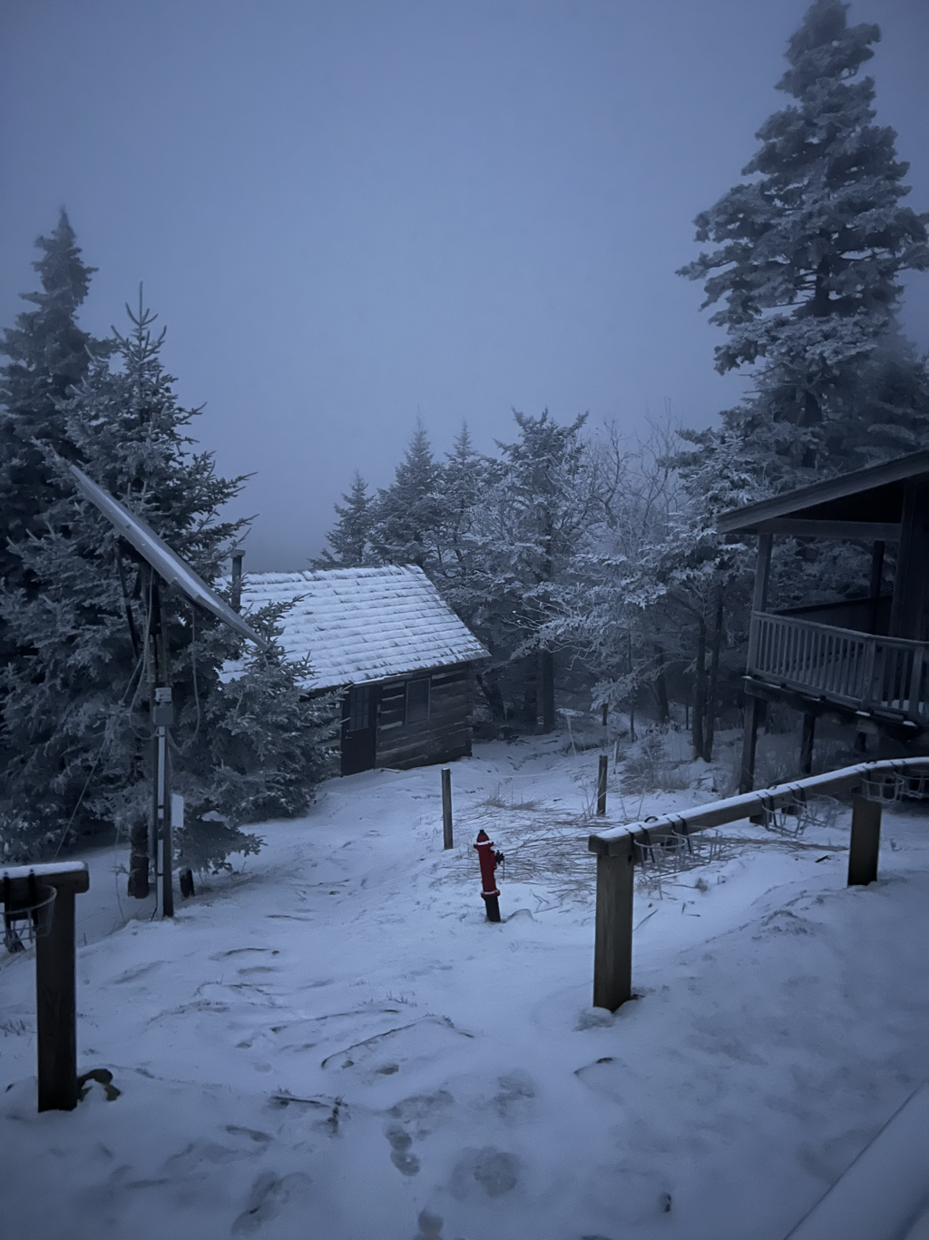 Good Morning, If you are looking for warmth and sunshine in the woodlands, best be getting after it today because it’s going to get real interesting beginning tonight. Partly sunny skies will be commonplace across the mountains the first half of today, but once we near supper time the clouds will thicken and the first rain chances arrive. Wind speeds will also be increasing as the day progresses, climaxing during a Wind Advisory set to take place from 7:00 PM tonight through 1:00 PM Friday. Gusts of 60mph are expected this high up. Breezy conditions will be a constant presence from now into Sunday. With the fast approaching Tropical Storm Nicole, a few inches of rain are forecast to fall from late tonight into early Saturday. Veterans Day will see the brunt of it lasting all day long. The storm’s track along with a cold front’s timing will play an important role in determining if plummeting temps and lingering precip will witness rain transition to snow showers on Saturday before skies clear. The entire weekend is set to be a cold one, with wind chills driving temps down into the single digits. Trails will undoubtedly be a wet and slippery mess during and after the storm, so definitely bring the traction devices for safe stepping this weekend. Layers for staying warm and dry are absolutely essential. Too often we see unprepared hikers reach the summit after a soaking wet ascent in a cold and miserable state because they didn’t have the sense to come prepared or turn around. This is not the time of year for day hikers to take such risks, so please don’t let that be you! Have a great day. 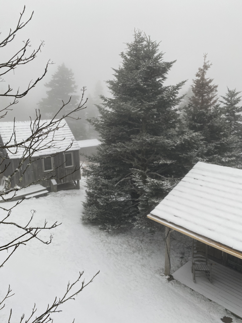 |
LeConte LodgeWelcome to the official blog of LeConte Lodge. We hope you find the information provided here both helpful and enjoyable. Thank you for visiting the site, and we hope to see you on the mountain! Archives
April 2024
|
 RSS Feed
|
|
|
|
|
|
