 Good Morning,
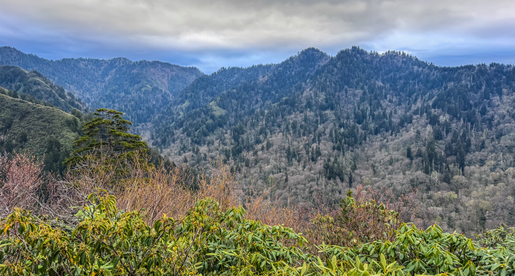
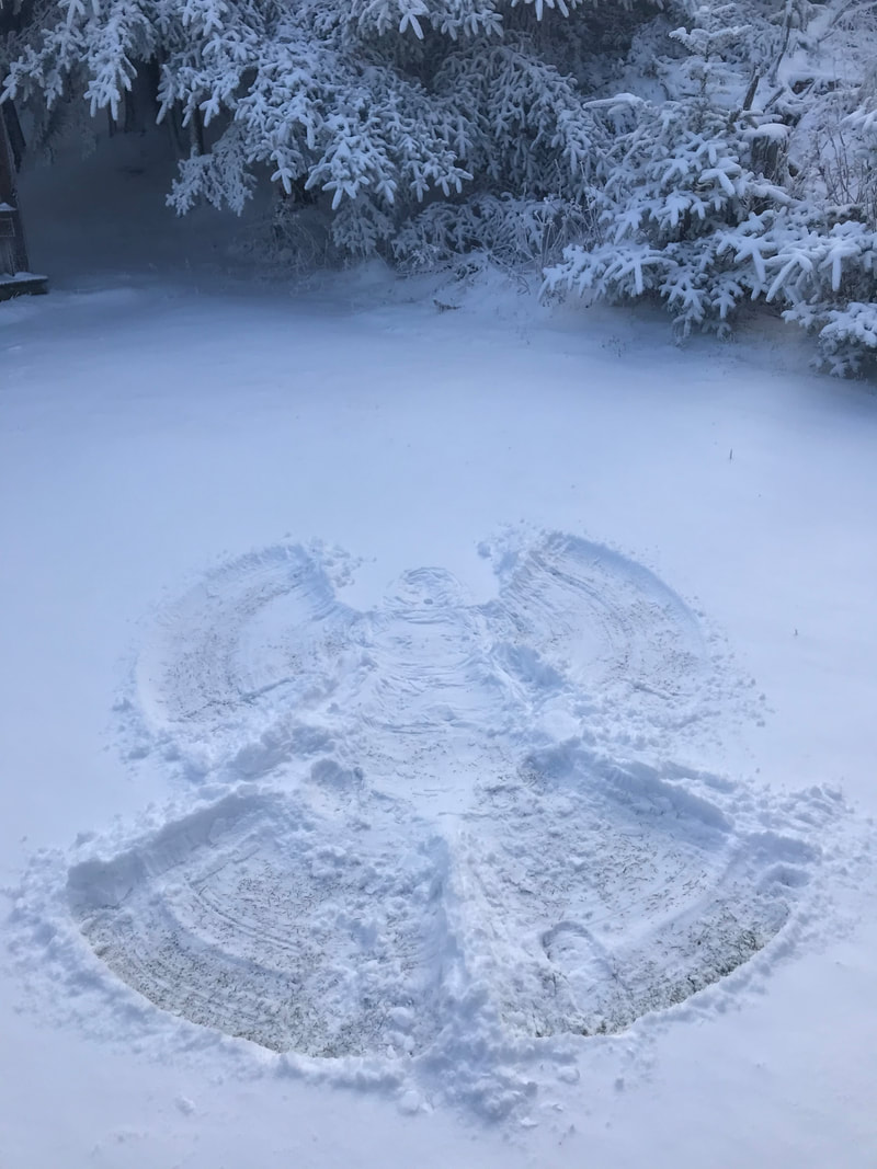
Superbly sunny skies greet guests atop the mountain this final Sunday morning of the 2023 season. Just three days remain, with today marking one of the great annual lodge crew traditions…Mountain Thanksgiving! Cooks and crew are excitedly preparing what should be a delicious feast for everyone who has put in tremendous work these past eight months. Temps dipped down into the upper 20s last night, as early risers will notice patchy frost around lodge grounds this morning. With the rising sun, conditions should warm quickly though, taking us well into the upper 40s this afternoon. Folks coming into town for the holiday would be wise to take advantage of today’s weather to hike the mountain, because the next few days leading up to lodge close are looking turbulent. Rain is expected to roll in Monday night, persist through Tuesday, then possibly transition over to snow showers Wednesday. Of greater concern is the High Wind Warning that will climax Monday night, calling for gusts of 70mph. If those winds precede any rain, areas around the national park still dealing with extreme drought conditions need to be on high alert. For us here inside the park, such high winds bring about the concern for newly fallen trees. Please take note of any you might see on trail while traversing the mountain this week. Thank you. Have a great day.
0 Comments
 Good Morning, It took a while, but some rain finally found us! Spotty showers will linger over the mountains this morning keeping trails and roadways wet, with the clearing of skies set to take place this afternoon. The remainder of this final weekend of the season should bring us ample sunshine. Temps are going to slowly slide down throughout today in conjunction with winds out of the north gusting near 20mph. We’ll shift from 40s this morning and bottom out near freezing tonight. Thankfully this cold snap is brief, as winds will swing back to coming from the south and help us jump back into the 40s for Sunday. Keep an eye out for slick and muddy sections on trail for the time being. Enough footsteps have marched up and down the mountain in recent weeks to thoroughly ground up fallen leaves into fine mulch, so there are no longer any obscured rocks and roots to also beware of. Have a great day. 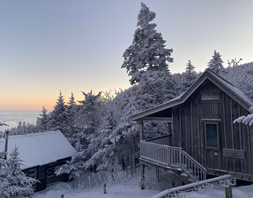 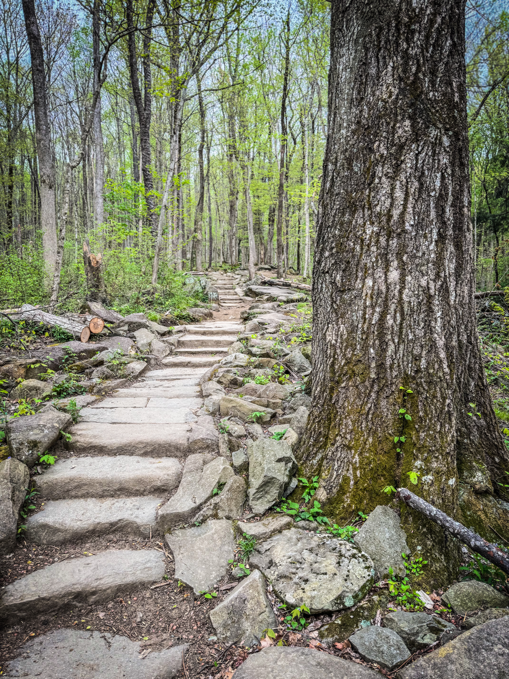 Good Morning,
You can count on one hand now for how many days are left in the season (unless you’re a polydactyl cat, which was yesterday). Skies will be a mix of sun and clouds to start this Friday, with the possibility of rain not happening until supper time today. And the precip can’t come soon enough to our region. Yesterday evening, GSMNP elevated their temporary campfire ban to park-wide, not just the backcountry, including use of charcoal in picnic areas. The fire risk in Sevier County outside the park boundary is also categorized as very high with burn bans being implemented across the gateway communities. Several fires have been popping up around the region in recent days, the most notable in size occurring east of the Smokies near the famous AT crossing of Max Patch. Local authorities have been prompt in their responses which is greatly appreciated. Assuming this forecast of rain actually comes to fruition, it is expected to last through the first half of Saturday before clearing off tomorrow afternoon. Sunday then looks delightful for outdoor ramblings on the mountain this final weekend of the season. Temps will spend much of their time in the 40s today, but once this front pushes through conditions will cool a bit and remain breezy. Remember those layers for staying warm and dry on trail and at the top. Have a great day. 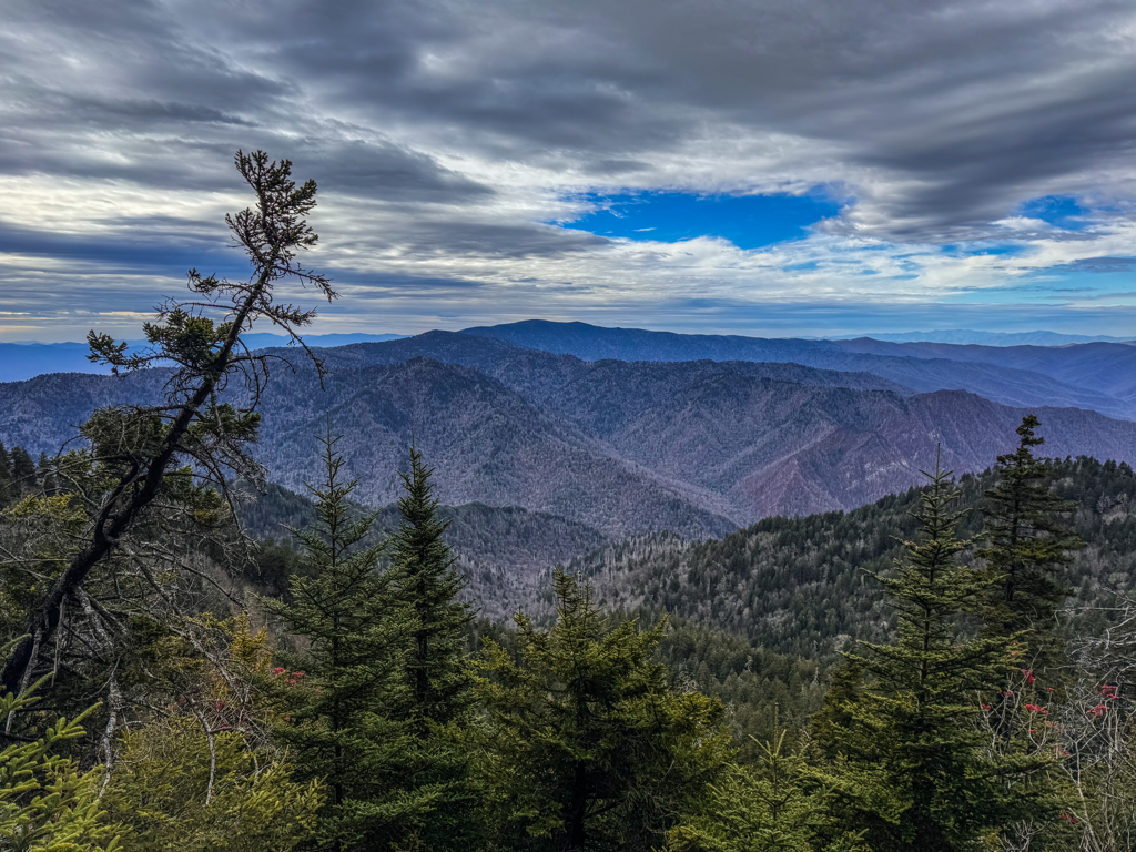 Good Morning,
There’s a great deal more sunshine to be had this morning across East Tennessee skies. It should be a beautiful day to ramble through the woods at any elevation. One can certainly tell it’s November and that the season is winding down. Trailhead parking lots aren’t filling up nearly as fast as they have the rest of the season, and foot traffic on the mountain tends to lessen once the thermometer drops and daylight hours wane. The lodge should get close to 50° this afternoon, but it will remain a little breezy over the peaks, gusting upwards of 25mph by tonight. Lows will likely dip into the 30s, or at least the windchills ought to, so remember the extra layers for sunset at Cliff Tops. Wet weather is on track to roll in tomorrow afternoon and linger through Saturday morning. This is a good thing, because fire danger in Sevier County remains classified as “very high,” and there have been small brush fires popping up in recent days. Kudos to the local responders for snuffing them out so quickly in the nearby gateway communities! The back half of the weekend should be pleasant and sunny. Have a great day. 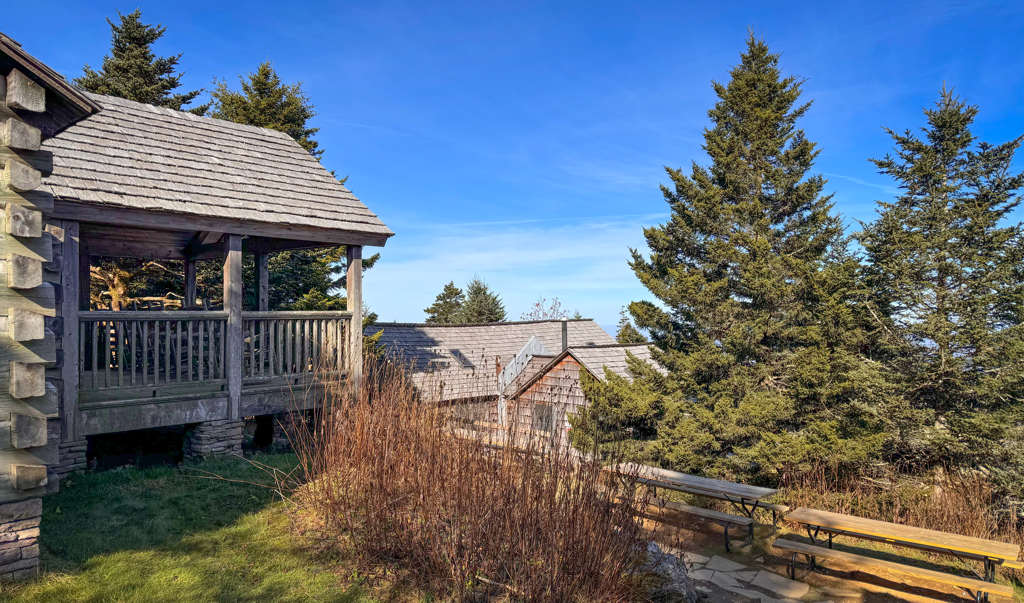 Good Afternoon, Here we are, solidly at mid-November and entering the vaunted “week of lasts” for the crew. Last rotations for selling shirts, baking cookies, flinging sheets, and scrubbing privies to name a few. By this same time a week from now, doors will be locked and windows boarded with everyone zipping down the mountain after celebrating another season in the books. Today has brought us mostly cloudy skies and breezy air. It feels a little chilly around the lodge as we dodge 20mph gusts, but anywhere on the mountain where the sun happens to be shining or is shielded from the wind feels delightful. Temps will continue to range from 30s to 40s up across the peaks today. We’re expecting slightly more sunshine tomorrow along with warmer temps near 50° in the afternoon. Leading into the coming weekend is looking a bit wet, which we won’t complain about given how dry this autumn has been. Have a great rest of the day.   Good Morning, These are the kind of November days we all enjoy. A healthy dose of sunshine, not too hot, not too cool. Except for when you’d reach the breezy and shaded tippy-top, it felt satisfyingly pleasant on trail yesterday. A repeat performance is expected this Tuesday, with mostly sunny skies, light winds, and temps ranging from 30s to near 50° later this afternoon. Trails are mostly dry now that were a few days separated from last week’s rain, but there are a couple lingering muddy places, so watch your footing there. Speaking of rain, there’s an ever-so-small chance for some precip late Wednesday night. Otherwise, we really aren’t anticipating wet weather to arrive until late Thursday. So that means decent hiking and porch sitting conditions for visitors these next couple days. Just a Beatles week remaining in the season! Have a great day.   Good Morning,
What began as a very cloudy and soupy sky is slowly but surely breaking up and thinning out. The sunshine is looking to take control of the situation and bring light and warmth (relatively) to the mountain. It’s cool at the lodge, to be expected for mid November, with temps ranging from 30s to 40s today. Winds out of the north will be light but enough that any visitor to the summit will want that jacket handy. After yesterday’s day long dreariness, trails will get a chance to start drying out this afternoon. Although we are quite glad to have finally experienced some rain and wet conditions, long overdue for this room. Much of this coming week looks promising for spending time in the woods while not having to wonder about turbulent weather, not until next weekend anyways. Just ten days remain in the 99th season of the lodge! Have a great day.  Good Afternoon, Thank you to all the veterans out there, from every branch of the military, as we recognize your service and commitment to country. Special shoutout to all those veterans who have and are making contributions both big and small to the lodge as employees. Regardless of the dreary weather, we expect to see numerous veterans spending time with family and friends in these majestic mountains this holiday weekend. Speaking of which, the clouds really set in thick overnight, confusing the ceilings and basements of fog and cap clouds. There’s been a steady mist throughout the day keeping conditions damp and cool. Temps will barely scrape the 40s this afternoon and certainly dip into the 30s overnight. Slight possibilities of rain showers will linger into tomorrow morning, but eventually skies should clear sometime Sunday afternoon. Even with just eleven days remaining in the season, we’ll make one last time shift for guest supper. Starting on Sunday 11/12, guests will be served supper at 6:00 PM. This still leaves adequate time for guests to catch sunset at Cliff Tops if clear skies allow and to make the trek back down safely. All other visitor service times will remain as is for breakfast and gift shop hours. Have a great rest of the day.   Good Morning, We haven’t quite gotten much in the way of rain in the last twelve plus hours, but if the radar is any help it indicates that something decent is finally on the way. And there are other favorable signs happening that will help our region’s cause today, such as the increased humidity and moisture with these clouds, cooler temps, and shifting winds blowing out of the north. What precip chances there are today will be their greatest this morning, then fizzle out after lunchtime. The next possibility, albeit small, won’t occur until late Saturday night. Skies at our elevation are likely to remain cloudy throughout the holiday weekend with only light winds. Those summer-like temps we’ve been enjoying are on their way out with this front pushing through. The thermometer is expected to slowly drop throughout the day, as we start near 50° this morning but will eventually find ourselves near 40° at supper time and then the mid-30s overnight. That is likely where our temps will remain over the next several days, so come prepared with the appropriate layers for staying dry and comfortable. And because it is a holiday weekend, expect gateway communities and all the popular spots in the Smokies to be bustling with visitors once again. Have a great day.   Good Morning, Yowza, we’re already down to less than two weeks to go in the 2023 season! It was a hot one yesterday on the mountain, and plenty of folks decided to hit the trails and soak up some (hazy) summer-like sunshine before autumn, and soon winter, return in earnest. Yesterday afternoon the winds picked up and shifted from out of the southwest, bringing along with it all that strong smoke from NC. The Collet Ridge Fire contributing to our less-than-stellar air quality of late has now increased to ~4,400 acres in size. Sevier County also kicked up their fire danger warning to “very high” yesterday, so until this supposed rain rolls in late tonight, everyone needs to continue to be smart and safe out there. Conditions throughout the Smokies remain very warm and dry at all elevations. A rainy weekend will do a lot of good in helping to quell this East TN drought. As soon as the raindrops start falling, we will all feel much better about our situation and add those kerosene lanterns back into the guest cabins. And as soon as the NPS deems it safe for campfires in the backcountry to resume, we’ll share that info. Thanks again for your understanding and support. Skies will be a mix of sun and clouds this morning and afternoon. It will remain warm until the precip arrives, but not as toasty as yesterday. The lodge could scrape 55° today, although winds will be gusting upwards of 40mph making it feel cool in places. Over the holiday weekend, intermittent rain chances will persist and winds will gradually change direction out of the north. That will bring the thermometer back down to a November norm…highs in the 40s and lows in the 30s. So bring everything you need to stay dry and warm over the coming days. Have a great day.  |
LeConte LodgeWelcome to the official blog of LeConte Lodge. We hope you find the information provided here both helpful and enjoyable. Thank you for visiting the site, and we hope to see you on the mountain! Archives
May 2024
|
 RSS Feed
|
|
|
|
|
|
