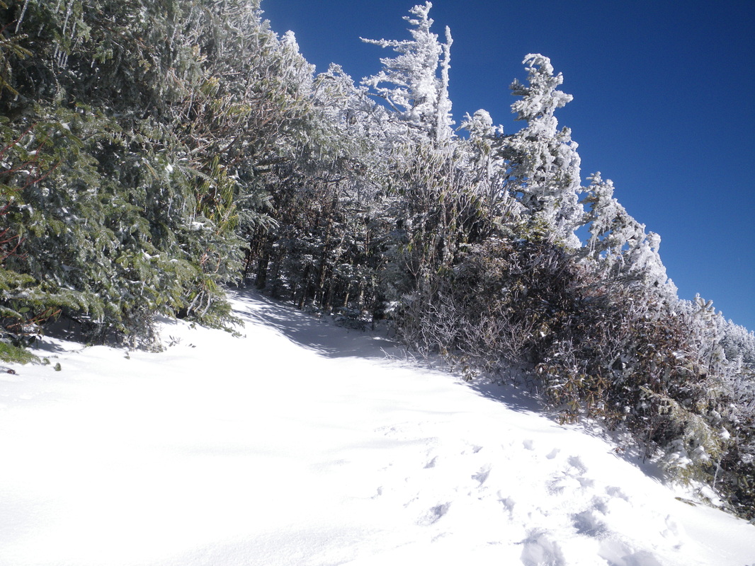
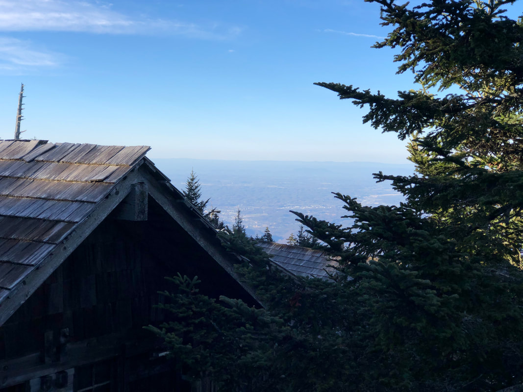
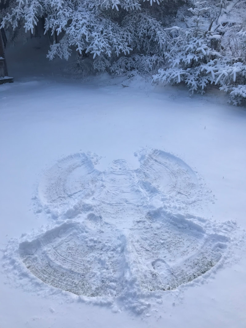
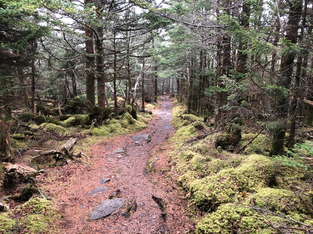
 The last tracks I saw until the AT. 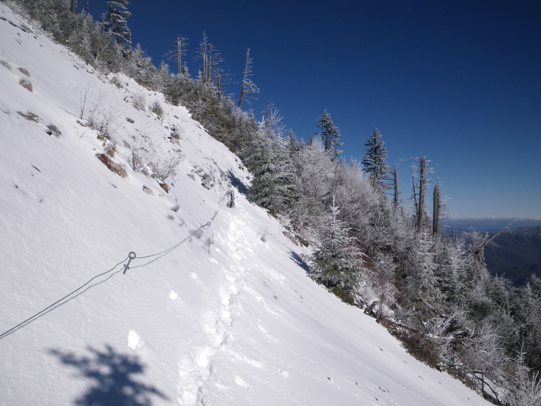 Even a little snow at the Slide can be precarious. 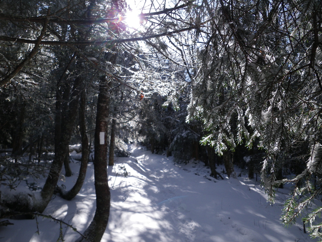 Getting back on the AT has the same familial warmth as seeing an old friend. 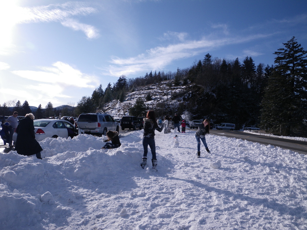 This girl is in the process of wailing her sister with that snowball. Direct hit! I've missed people watching. Morning, It was a beautiful day yesterday. The high was 35 degrees. The low was 24 degrees. It was 34 and clear at observation. Today looks like it'll be another stunning day to be in the mountains. Be wary of black ice - there will surely be some on Alum. I had some beautiful hiking over the last two days. I left the lodge at around 11:30 on Thursday. I would've caught an earlier start, but my friend Ryan was racing cyclocross in Belgium and I was fortunate enough to find the live feed. Watching bike races always gives me a beautiful shiver up my spine in remembrance of the pain of past races. It's a great boost of energy and helps to put things in perspective. Hiking is literally a walk in the park after watching those men suffer with their pride at stake. I hiked out Boulevard. Even with 'only' 5 inches of snow, the drifts were pretty nasty. There were a few sections with snow that came over my gaiters. It was awesome fun. Breaking trail for the first time all winter is what I'd imagined this job would be like. Better late than never! I made it to Newfound Gap around 2:30 and realized I wouldn't be able to make the Dome. I'll have to save it for another trip. I managed to get to Mt. Collins shelter just at dark. There were still some nice colors in the clouds as I got ready to crawl into my sleeping bag. I was up early in the morning and hiked back out to the Gap. The sun was special coming up through the red pines. Special thanks to Neil, Greg, Mark and Doug for helping me get myself and all my gear back from the mountain to the office to the trailhead yesterday. I started back up Alum at 6. It was a perfect night for a hike. It was clear and cool. The stars felt like a pop up book. It was a great experience that is beyond my limited attempts with words or a camera to convey. You'll have to take my word for it. Please remember that we are CLOSED for the season. If you are running out of daylight, turn around before you reach the top. One of the great virtues of mountain trekking is self-reliance. You only learn it by being prepared, knowing your limits and taking in stride the challenges that Mother Nature provides. If you expect others to bail you out, you're not just being a fool - but you're also missing out on the beautiful lessons that the mountains can teach you. Take responsibility for your actions. 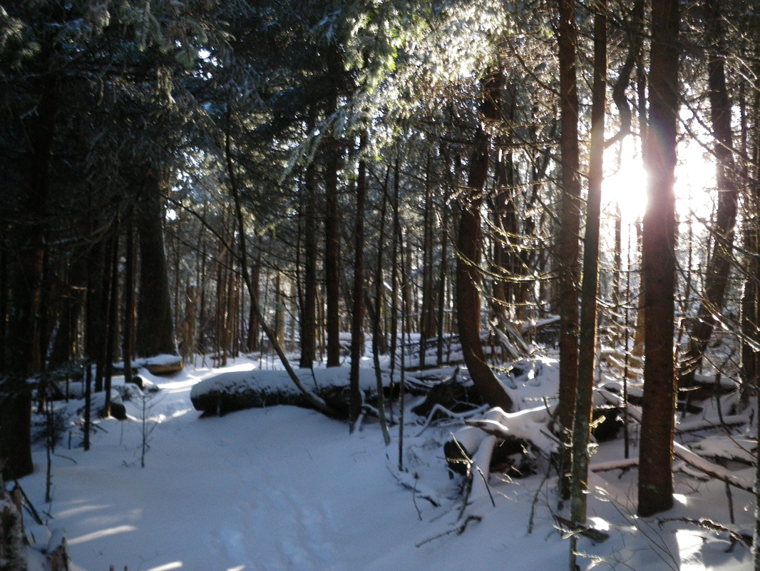 Sun setting on the way to Mt. Collins. 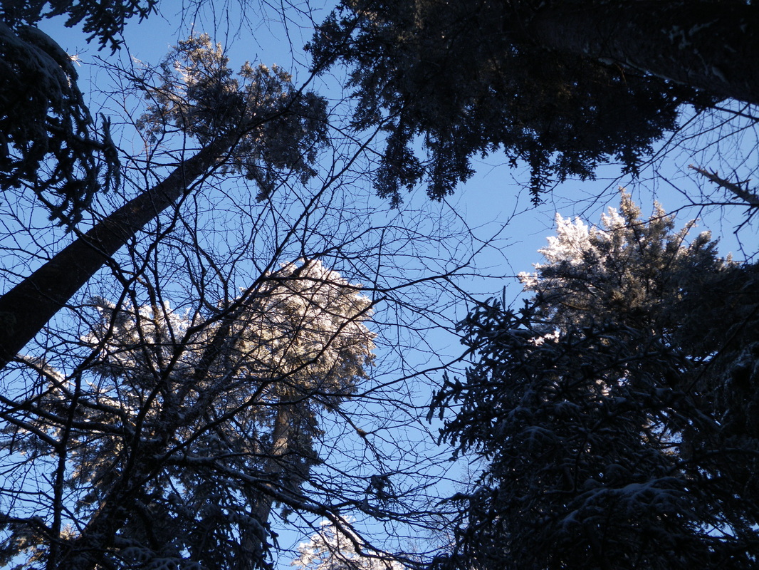 Last bit of sun hitting the tree tops. 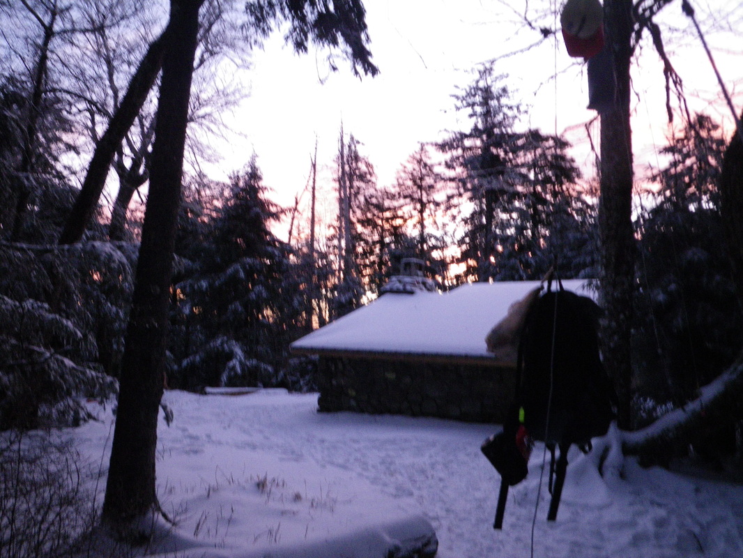 Sunrise over Mt. Collins shelter. 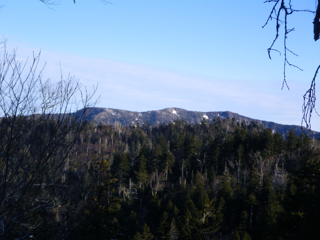 View of LeConte from Mt. Collins ridgeline. 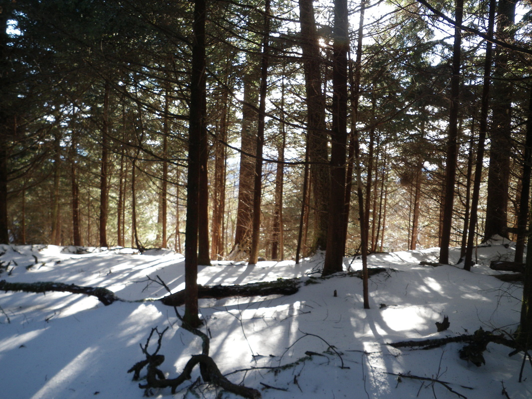 Sun peeks through red pines.
Raz Theo
12/30/2011 01:41:17 am
J.P.,
Dewayne
12/30/2011 01:51:17 am
JP,
Bruce
12/30/2011 03:06:48 am
Thanks for the pics and the story. I always read and just seldom post. This is one of the first blogs I read each day. Thanks!
tomk
12/30/2011 03:28:55 am
The photo of Mount LeConte from Mount Collins ridge is shows the "Three Peaks" of Mount LeConte. On the far left, partially obscured by the trees, is Cliff Tops, where everyone goes to watch the sunset. The center peak, with a snow covered arrow practically pointing it out is High Top, the highest point on LeConte. I am guessing that the photo posted the other day was either taken on the snow arrow, or from the opposite side. The trail from High Top to Myrtle Point is almost a knife edge at points. Myrtle point, the less pronounced peak well to the right of High Top is an awesome place to bake on the rocks on summer afternoons, and THE place from which to watch the sun rise. The Lodge is not visible in the photo, but if you could see through rock, it would be just to the right of Cliff Tops on the hidden side of the mountain. At Cliff Tops, one watches the sunset by looking toward but left of the camera. The sunrise is seen by facing away from this camera location and slightly right. Sunrise, sunset, it's always gorgeous on LeConte.
Paul B
12/30/2011 03:53:38 am
Tom, thanks for the geography insights. I always get turned around. Given your knowledge you may be able to help with a question. When viewing sunsets from Cliff Tops there are two rounded peaks in the foreground, what are these called? Are they West Point or Balsam? Can they reached by trails? I have beautiful photos of the sun setting betwen them and am curious of their names, (if any).
tomk
12/30/2011 07:05:47 am
@Paul:
Paul B
12/30/2011 09:14:00 am
Tom, thanks for the additional information. Very helpful as always. We hiked down Bullhead two years ago in a steady rain and couldn't see much.
tomk
12/30/2011 10:12:24 am
@Paul:
Paul B
12/30/2011 11:30:33 pm
Tom, thanks for the help. I always like to know what I am looking at. I can't wait to catch another sunset this August
Barbara
12/30/2011 02:38:57 pm
tomk, Thanks for the perspective on that pic. I like to know what I'm looking at to feel oriented. Appreciate it.
Bob B
12/30/2011 04:20:10 am
Unbelievable pictures!!!! JP, thank you so much for sharing the pictures and blog with us. I look forward to this site every day. I can't wait for our trip back up to the lodge next August
Anthony W.
12/30/2011 04:44:45 am
Outstanding report and pictures!
Jacque J
12/30/2011 04:53:51 am
J.P. Was so nice to meet you on Christmas day . My husband and I hiked up to the top and spoke with you outside by the restrooms. It was cool for us to hike up on Christmas day and to get to meet the winter caretaker! We follow the blog daily and love all your pictures! Was on of our best hikes ever!
Jacque J
12/30/2011 04:53:52 am
J.P. Was so nice to meet you on Christmas day . My husband and I hiked up to the top and spoke with you outside by the restrooms. It was cool for us to hike up on Christmas day and to get to meet the winter caretaker! We follow the blog daily and love all your pictures! Was on of our best hikes ever!
Don P.
12/30/2011 05:32:45 am
Gorgeous pictures and commentary. I feel like I am right there with you. I am enjoying this so much. I wish I had followed this blog years ago. Have a very Happy New Year. Stay safe. I too enjoy and comment on your post everyday. Looks and sounds like u had a wonderful hike. That would be awsome hiking at night. Did u hike by the moon and headlight? I myself would be a whimp and want someone to go with me. The people on this sight really know there mountain. I need to take one of you fellow hikers with me to be my tour guide someday. Thanks so much to all of u and to u JP for making this blog something great for everyone to read and glorious pictures to look at every day. U bring a little greatness into the dulldrums of winter.
Alan
12/30/2011 06:01:15 am
Awesome stories and photos today JP!
Devin R.
12/30/2011 06:43:09 am
I'm so disappointed in the late start to the snow! After seeing this blog from last year, I was really expecting some snow in Mid December instead of the 65 degree weather we had.
Dave Brattan
12/30/2011 02:15:55 pm
I'm sorry that your life ends.
Doug Y.
12/30/2011 04:55:00 pm
tomk was right about West Point and Balsam Point; I've hiked to each a couple of times, but that's been a while ago; JP: I hiked up to the lodge about ten years ago, under a clear cool sky, and as you said, it's a marvelous experience, one that will invigorate you intensely; I continued that night down Trillium and walking under Grotto Falls in the dark was refreshing; I get two or three good nightime treks in each year, somewhere in the Park; My headlight is a simple Eveready;
Kelly....{a guy}
1/2/2012 04:00:29 am
I thought you find it encouraging that I check your post everyday....Really enjoy the quotes Comments are closed.
|
LeConte LodgeWelcome to the official blog of LeConte Lodge. We hope you find the information provided here both helpful and enjoyable. Thank you for visiting the site, and we hope to see you on the mountain! Archives
June 2024
|
 RSS Feed
|
|
|
|
|
|
