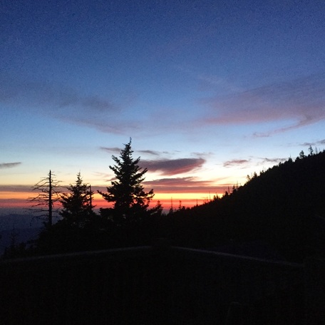
 What a beautiful way to start the day! Hello, hello! I hope that everyone's day is going well so far. We are gearing up for a busy weekend here on the mountain. Yesterday's high was 60 and the low felt chilly at 40 last night. Sunrise this morning was beautiful and fairly clear with a few wispy clouds to catch the color. Currently though it is 53 and cloudy. Everyone have a wonderful day!
Kent
5/14/2015 06:22:48 am
Sooty black shadows of the nocturnal world
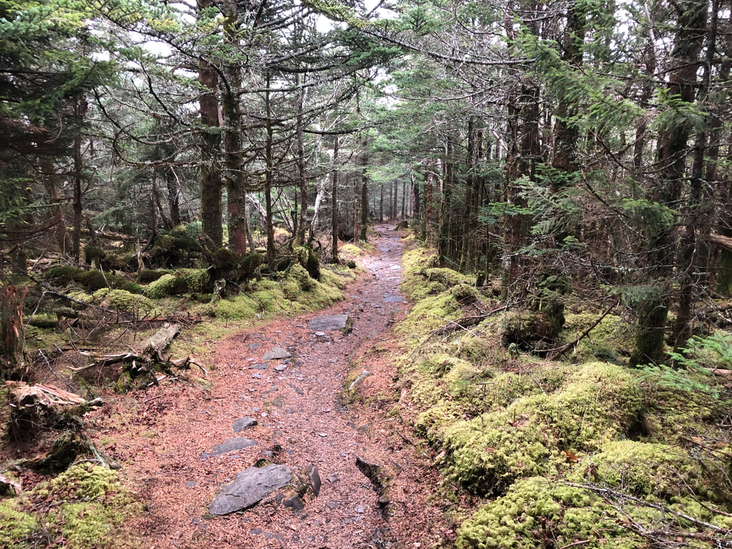
Nice words Kent. When I'm at the Lodge I enjoy the sunsets from simply sitting on the back porch of the dining hall or in a rocking chair at any of the cabins (especially Cabin No. 9). Cliff Tops is, of course, perhaps the best viewing location, but almost anywhere up there suits me. Driving by the Alum trail parking lot a couple of days ago was a bit weird, seeing so very few vehicles there, crew members I assumed and Park workers, etc., but those workers do a hard and necessary job and I appreciate all of them. Camped three nights at Elkmont and enjoyed some nice cool nights, but as usual was wishing I was up on the mountain ! Hiked the Old Sugarlands Trail from the Rainbow Falls parking lot / trailhead down to the Sugarlands Visitor Center, 3.9 miles, all but the initial 0.4 mi downhill. Wide open trail called "easy" in the trail guidebooks, but I wouldn't relish "ascending" this trail myself ! Not spectacular, just an easy descent and a decent day hike for anyone. Saw one bear during the final mile but he/she was in a hurry going in the opposite direction ! Commented more on this hike on my own site.
norman
5/14/2015 03:11:06 pm
Doug, enjoyed the read and pictures on your post! Glad to see you back down in GSMNP. You and people like you are my connection to the park! HAGD
Barbara
5/15/2015 12:48:06 am
Doug. I'm curious. Where was your car? If you did a one way hike how did you get to the start or back to the start when you finished? I would like to do that hike this summer. Barbara: this hike requires either two vehicles or a shuttle service unless you do the route "round trip" which would be 7.8 miles. The ascent could be quite strenuous for some, but the descent is easy enough; as I wrote on my own site I think, it's not a spectacular trail such as like the Alum trail, but pleasant, quiet, and satisfying at a decent day hike distance. Lots of old rock walls in the last two miles or so to discover. Lots of history in this Sugarlands Valley. Barbara: I meant to add that if you do this hike, starting at its upper terminus at the Rainbow Falls parking lot / trailhead is the easiest and I highly recommend getting there as early in the morning as you are comfortable with because it will get crowded rapidly as the morning progresses. Hiking the first half mile or so with a headlamp just before sunrise is also a pleasant way to begin any hike in my opinion. You can usually park a second vehicle at its lower terminus which is by the rock bridge across the road from the Sugarlands Visitor Center; there's just enough space in a narrow lane fort about five cars over there. Hope you make this trek.
Cougarpass
5/15/2015 02:53:58 am
Enjoyed you post Doug. Kent, you are a poet.
Tammy (Tx)
5/14/2015 05:28:26 pm
Beautiful sunrise pictures yesterday and today! It's been a day of reflection...my dad passed away 5 years ago today and I have many fond memories of trips we took together to the park. He loved the GSMNP as much as I do. About a year or so before he passed he told me he just wished he could visit the area one more time...he didn't get the chance. I'm sure he visits in spirit. Here's a shout up to dad! That's why I was so impressed by the 88 year old man that still hikes Leconte. Just had to share.
Tammy (Tx)
5/14/2015 05:50:19 pm
Doug, just read your post on your site. Just want to let you know I really enjoy reading about the different trails you hike and experiences you have in the park. I'm still wondering if you or anyone reading this has hiked up to Gregory's Bald. I assume the trail starts in Cades Cove. Just interested in knowing more about this trail.
kat
5/15/2015 01:23:34 am
Tammy I have hiked the Gregory Balld trail 4.4 mi. [not a hard trail at all and beautiful view of all Cades Cove from top,] mid june to end of June entire top covered in azaleas of every color. The only thing is for that trail you have to take the one way Parsons Branch road which brings you out in NC., it is no problem for me as I live in NC. The Gregory Ridge Trail is a little longer and is on a 2 way rd in Cades Cove, so if you are in TN. that might be your best option. LeConte and Gregory Bald are my favorite hikes for great views. Hope this helps
ric
5/15/2015 05:13:54 am
also, depending on your "enthusiam", i did a gregory bald loop. up gregory ridge to gregory bald and return down parson's branch road. be a little more than up and down rainbow and bull head but at least the road part is down hill. also, check trail conditions- gregory bald was closed much of last summer due to bear activity. the azelas are well woth the trip. start early and enjoy.
Tammy (Tx)
5/15/2015 07:51:34 am
Thanks ya'll! Ok, let me see if I have this figured out....could we take the Gregory Ridge trail off the two-way part of Parsons Branch road up to Gregory's Bald and back down the same trail to avoid having to go on the one way section of PB road? I'm usually in a rental vehicle and have been afraid to drive the length of PB road. Also is the trail well marked. Another thing, I love the bears in Cades Cove but don't really want to see one up close and personal on a trail. That's already happened to me in the northwest.
ric
5/15/2015 08:13:48 am
in and out on the same trail is always a possibility. depending on how far up gregory ridge you go, the loop would actually be shorter. parson's branch road ends close to the trail head in cade cove. bears are bears, you just never know.
Tammy (Tx)
5/15/2015 05:17:54 pm
Thanks again! I appreciate all the info I can get. I know some of the park rangers and interns in Cades Cove like to hike that particular trail and was wondering about it. Kat, Ric, Doug....if you can tell me how long it takes to drive Parsons Branch road and road conditions. I have a jeep commander but usually fly to TN and get a rental. A couple of years back, one of the park rangers told me it was basically an old wagon trail with very little improvements made since then...with several water crossings...and high centers. I've driven Rich Mt. Road several times before.
Kat
5/16/2015 12:45:07 am
Tammy, Parsons Branch is a beautiful drive of abt 8 mi. The creek crossings are concreted and easy to cross, some are abt. 1 foot deep. Road is closed at night so start early and go on day when cove is not closed for bicycles [wed and sat] We came across in a Rav4 after a 4 hr down pour [got caught one the mtn and hiked all the way down in a thunder storm and was still pouring] we had no problems but if we had a lower car we might have had to wait til water went down. You will exit on 129 {Dragon Trail] Take a left toward Fontana then back to Cherokee and across 441. Take a right toward Chilhowee then up thru Maryville. The roads in last 2 sentences will take some time too. Hope this helps you.
Tammy (Tx)
5/16/2015 05:10:13 pm
Thanks Kat! I think my husband and I will make sure we drive Parsons Branch this year. Hiking to the top of Leconte is another goal of mine this year but not 100% sure I'll make that one. I've visited the GSMNP 1 or 2 times each year for the past 37 years and I'm pretty familiar with the surrounding area. Comments are closed.
|
LeConte LodgeWelcome to the official blog of LeConte Lodge. We hope you find the information provided here both helpful and enjoyable. Thank you for visiting the site, and we hope to see you on the mountain! Archives
June 2024
|
 RSS Feed
|
|
|
|
|
|
