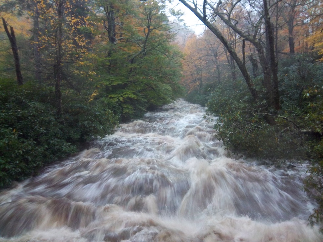
The water rages just underneath the first footbridge near the Alum Cave Bluff Trail parking lot at 5:52 p.m. Tuesday.
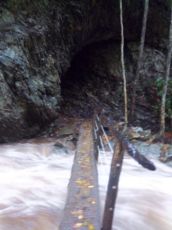
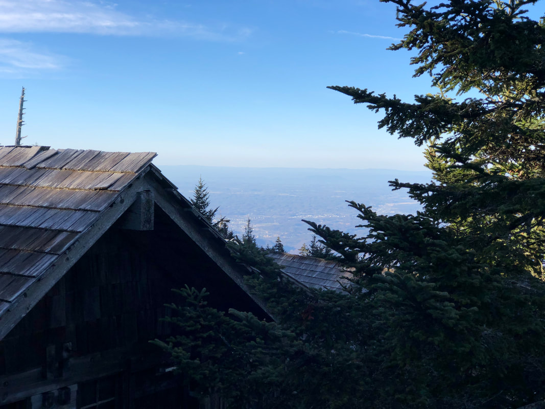
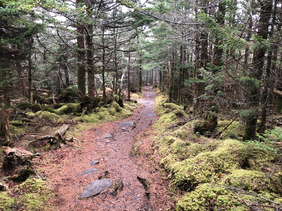
Good afternoon to all of you High on LeConte readers. This is Nathan, patching in on today's update. We've been staring at a heaping helping of gray today above the top of Tennessee. Wednesday's high only reached 40 with an overnight low of 34. We've not budged much from that morning low, as we're reading about 37 degrees at 2 p.m. Thursday. We'd be dealing with a white carpet if the temperature had dropped another few degrees. We added another 0.41 inches of rain Wednesday to augment our soggy October. We received more rain Tuesday (officially 5.56 inches, but that total rises north of 6 inches if you count the total during the overnight hours) than we did in all of September, 5.42 inches. September down in the Tennessee Valley was historically dry. The folks in our office in Sevierville would like to remind you about our online store. Feel free to browse through and see what you might like. I feel certain that merchandise would look better on your back than in our storeroom. Plus, that may give you a few good Christmas shopping ideas and keep you out of the madness that is Black Friday. Maybe you could go hiking instead. In particular, the 2015 LeConte Lodge calendars are on sale. We'll still only sell the "I hiked it" shirts at the lodge to protect the people who made the journey. I'd like to thank the Park Service trail crew for doing a quick and thorough job clearing Alum Cave Bluff and Trillium Gap Trails to LeConte. The mountain took a beating in the rain and wind Tuesday, but the trail crew's made the hike much better for our guests. I don't have any updates on Boulevard, Rainbow Falls or Bullhead Trails. If you have an update on any of the above, feel free to share it. I hiked down last Friday in between bouts of bad weather. I got lucky, and the afternoon hike down Alum was nice. Below about 5,000 feet I started to see some welcome color on the foliage. In particular, there was a stretch of yellow leaves carpeting the trail, rendering the effect of the yellow-brick road from "The Wizard of Oz." Had I known the might of the wind that would soon howl across the mountain, the movie would have been an even better comparison. Also, I noticed the vibrant red of the sugar maple descending below Inspiration Point. Is there any tree more glorious than a maple in the fall? Looking out at the green, red, yellow and orange across the ridges reminded me of opening my wallet this winter in Uganda and all the colorful currency peaking back at me. The good, old U.S. dollar spends a lot better at the lodge, but it's not nearly as pretty as Ugandan currency. My trip back to work on Tuesday proved not quite so pleasant. The normally placid stream below Arch Rock on the Alum Cave Bluff Trail looked like Olympic-caliber Class V whitewater on the Ocoee River. I've never seen that trail so dangerous as when I began hiking near the conclusion of the downpours at 5:52 p.m. I didn't arrive at the lodge until 9 p.m. I couldn't believe the ferocity of the stream licking ever so close to the first two broad footbridges near the Alum Cave Bluff parking area. Once I crossed the second broad bridge, I was stunned to see that the stream had engulfed the entire trail. I had to plow through knee-high, churning, turbulent water for about 1/3 of a mile--guaranteeing my boots were about three times as heavy as they should have been for the remainder of my 5-mile hike. While I was wading through the section of trail so wet it could drown a trout, I heard an eerie sound. At first, it sounded like muffled thunder. However, it wasn't distant at all, but close and the weather was finally beginning to break. I figured out that the force of the main body of the stream was so powerful that the muffled clicking I heard was a host of boulders being shuttled down the creekbed crashing their way to new homes downstream. I've never been so close to turning around on a trip up to LeConte. Had I not had to report for work, been worried about finding guests in harm's way on the trail and wanted to provide the best reconnaissance for our overnight guests and trail crew, I would have turned around and faced LeConte another day. I was carrying about a 50-pound pack and had to squirrel through some of the limbs on those downed trees in the dark (I did have headlamps). I certainly appreciate the good work of the trail crew. I've attached some photos, but I still can't believe the fury of the water that day. Because we haven't seen the sun in quite some time, our solar power is just about gone. The forecast is improving, but we'll need some sun to recharge before we can post another update. If our LeConte Lodge battery power was an event in U.S. history, we would be standing beside Gen. George A. Custer on Last Stand Hill at Little Big Horn. Thanks for reading. Come up and see us. Happy trails. 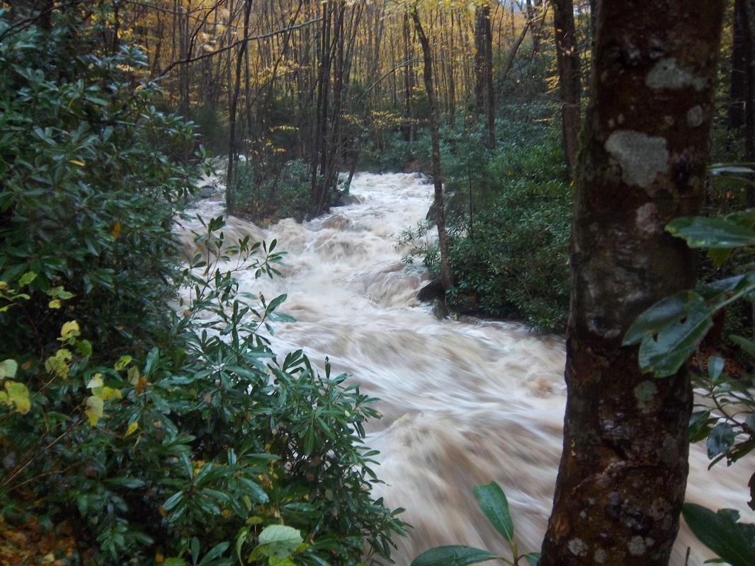
The water comes close to overtaking the logbridge approaching Arch Rock on Tuesday evening.
11 Comments
elktonbrant
10/16/2014 08:41:36 am
Wow. Thank you Nathan for your dedication to your assigned job and to your dedication to make sure that nobody was stuck on the trail. The pictures are actually scaring me just looking at them!
Kent
10/16/2014 08:51:33 am
Furious and dangerous looking currents, indeed! It makes you realize just how indifferent nature is to our safety and concerns. Glad you made it back up in one piece, Nathan.
jeand
10/16/2014 08:56:25 am
I agree that is some scary looking water coming off the mountain. It makes for a really pretty picture but thinking of you, Nathan having to brave through the rush of water on the trail makes me shudder. You are a brave, dedicated Mt LeConte man. Thanks for the story and all you do for the hikers and those of us who only get to read about it (at this point anyway)
Rebecca
10/16/2014 10:06:58 am
Glad you made it back up top. I know what you mean about the water. Roaring Fork was a torrent as well. Sitting across from it we could not hold a conversation. The boulders were so loud it reminded us of cannon fire off in the distance. We have only seen the water like that once before years ago. A May storm brought on a flash flood a 3-4 ft torrent down the stream. It was chaos.
Val
10/16/2014 11:12:43 am
They said Clingmond's Dome got 4" rain on Tuesday & in Gatlinburg river water was on River Road at 6PM Tuesday!
Gulf Coast Doug
10/16/2014 12:53:12 pm
Been a wild week visiting here. All this rain seemed to have the Elk working to move around the floods. Saw two huge elk standing a half mile from our cabin on Maggie side of Blue Ridge Parkway. Long ways from Cataloochie. Jonathan Creek was rushing whitewater. Seemed to block their pathway to woods...temporarily.
Debi
10/16/2014 10:54:18 pm
Wow! What a adventure you had! Crossing that bridge is always kind of scary for me anyway. With all that water,Wow!!! Had to put that on my screen saver to show hubby when he gets home. Glad you made it to work safe. Yes, the picture of the bridge was terrifying. But the phrase "I had to plow through knee-high, churning, turbulent water for about 1/3 of a mile" just freaks me out. Nothing scarier than walking where you can't even see where your feet are supposed to be going. And then hearing the boulder roar. We heard that once. But we were in bed in a motel room next to a creek (on the road to Cosby), NOT hiking up Alum. Jeez! Your job is envied by many, but then we occasionally realize that the barrier between awesome exhilaration and real and present danger is a thin barrier indeed. Stay safe.
Kim
10/17/2014 06:24:08 am
Wow..glad we came when we did the first weekend of the month. I think we less experienced hikers would have indeed turned around and tried another day. So glad you made it safely and hope your boots dried out.
Sherleen C.
10/19/2014 10:23:56 am
I am missing the blog and pictures .Spoiled me ! I am assuming solar power is history, temperarily .God bless all of you ! Happy safe trails . :-) Leave a Reply. |
LeConte LodgeWelcome to the official blog of LeConte Lodge. We hope you find the information provided here both helpful and enjoyable. Thank you for visiting the site, and we hope to see you on the mountain! Archives
June 2024
|
 RSS Feed
|
|
|
|
|
|
